Grey Belt Site Triage: A Practical First-Pass Checklist for Land Teams
An eight-part first-pass process for assessing whether a Green Belt site merits proper grey-belt planning work.
7 min
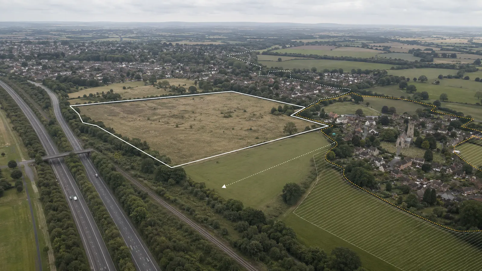
Grey belt is not a new colour on the constraints map. It is a policy definition that has to be tested against the character and function of the land, other protected assets and the wider requirements for development in the Green Belt.
For land teams, the sensible first step is not to label every previously developed or visually untidy Green Belt site as an opportunity. It is to run a disciplined triage that separates sites worth proper planning work from sites where the label is unlikely to change the outcome.
Start with the actual definition
The December 2024 National Planning Policy Framework defines grey belt as previously developed land and/or other Green Belt land that does not strongly contribute to three specified Green Belt purposes: checking unrestricted sprawl, preventing neighbouring towns from merging, and preserving the setting and special character of historic towns.
The definition also excludes land where the policies for certain other protected areas or assets would provide a strong reason for refusing or restricting development. That is why a site cannot be assessed from aerial imagery alone.
An eight-part first-pass check
1. Confirm the designation
Check the adopted policies map and any relevant emerging-plan material. Record whether all or only part of the site lies in the Green Belt. Do not rely on a portal layer without retaining the policy source and date.
2. Test the three relevant Green Belt purposes
Ask for evidence, not adjectives.
Would development extend a large built-up area in a way that reads as unrestricted sprawl?
Would it materially narrow an important gap or contribute to the merging of neighbouring towns?
Would it harm the setting or special character of a historic town?
The answer depends on settlement form, intervisibility, landscape structure and the scale of development proposed. “Scruffy land” is not the test.
3. Check the exclusions
Review the policies associated with the NPPF’s protected areas and assets, including flood risk and relevant heritage and ecological designations. A site that looks weak in Green Belt terms may still face a strong policy reason for restriction elsewhere.
4. Test the effect on the remaining Green Belt
Grey-belt status is not the end of the Green Belt test. For development to avoid being treated as inappropriate under paragraph 155, it must not fundamentally undermine the purposes of the remaining Green Belt across the plan area.
That requires a wider view than the red line. Record the site’s relationship with the settlement edge, gaps, countryside and the authority’s overall Green Belt structure. A plausible site-level grey-belt argument can still fail at this step.
5. Confirm the unmet need
Paragraph 155 also requires a demonstrable unmet need for the type of development proposed. For housing, the framework explains when this condition is met, including where the authority cannot demonstrate a five-year supply of deliverable sites or where Housing Delivery Test performance falls below 75%.
Record the current evidence and its date. Do not treat a past shortfall, a consultation proposal or a consultant’s assertion as the live position.
6. Test sustainability
Grey-belt status does not answer whether the location is sustainable. Record access to services, public transport, walking and cycling routes, the settlement hierarchy and the likely transport response. A site can pass one policy question and fail the location question.
7. Price the golden rules
Where the golden rules apply, affordable housing, infrastructure and accessible green-space expectations can materially affect land value and scheme design. Treat these as appraisal inputs at the start, not planning conditions to think about later.
8. Record evidence and uncertainty
The output should state:
the evidence reviewed;
the site’s contribution to each relevant Green Belt purpose;
other policy restrictions;
the effect on the remaining Green Belt across the plan area;
the evidence of unmet need;
sustainability strengths and weaknesses;
likely golden-rules implications;
the confidence level;
the next evidence required.
What not to automate
AI can collect policy documents, compare evidence, identify missing inputs and keep the assessment linked to the site record. It should not quietly turn a subjective landscape and planning judgement into a definitive green tick.
The useful workflow is:
assemble the correct source material;
produce a structured first-pass assessment;
expose the evidence and gaps;
route borderline sites to the right planner or technical adviser;
retain the final human decision and reasoning.
That makes the team faster without pretending the policy test is mechanical.
The commercial decision
A grey-belt screen should end with a decision, not merely a description.
Reject: the site strongly performs a relevant Green Belt purpose or is blocked by another major constraint.
Hold: there may be an argument, but emerging policy or missing evidence makes expenditure premature.
Investigate: commission targeted landscape, heritage, transport or planning work.
Pursue: the first-pass case is credible, the location is sustainable and the commercial appraisal reflects the likely obligations.
The purpose of triage is not to prove that a site is grey belt. It is to decide whether the next pound of planning spend belongs there. Grey-belt status alone is not a permission and does not displace the rest of the development plan.
Sources

Article written by


